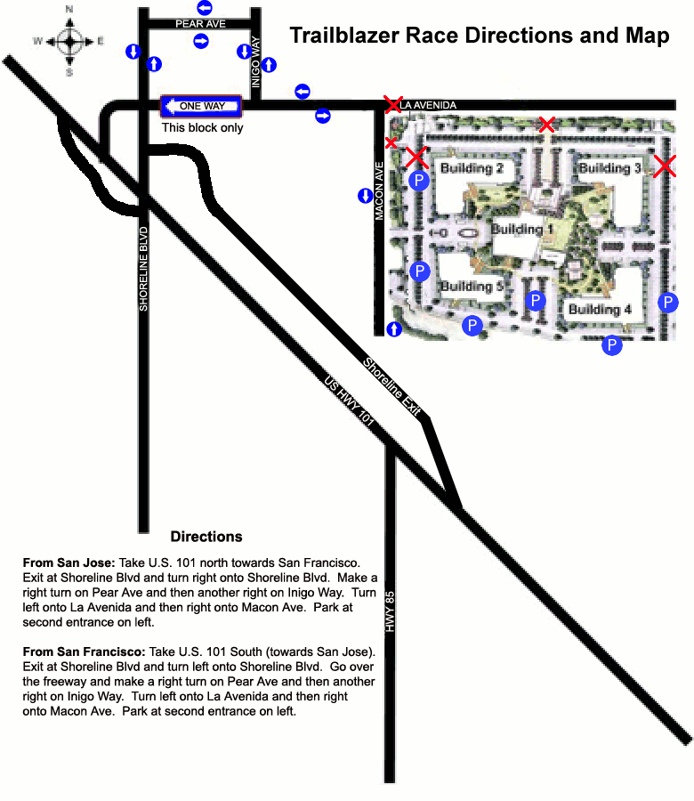
Directions to Friends of Stevens Creek Trail Trailblazer Race
Here's a
Google MAP to the parking area, but be aware that this area was recently substantially changed
and that is not yet reflected in Google, Yahoo, or Mapquest maps.
You can use it still to get you close, but then follow these directions and the map at the bottom
to get you the last few blocks.
Also, there are signs along the way to help guide you to La Avenida, so watch for those.
Once you are heading north on Shoreline, past the Hwy 101 overpass, follow these.
you can no longer turn right onto La Avenida.
Instead, continue another block and turn RIGHT on Pear Ave.
Take the next RIGHT on the new street, Inigo Way
Turn LEFT when you reach La Avenida
Turn immediately RIGHT onto Macon Ave
Follow the cones to pull into the parking lot on the left near the end of the street.
Parking is near buildings 5 and 4 shown in the map below.
Once parked, walk through the center of the campus to the front (top) of Building 1. All the festivities
are between buildings 2 and 3.
Here is another map showing detail of this area.
Also, we will have flaggers and signs out to help you find the race.
This page last updated