Stevens Creek Trail Guided Tour
Home Page

Friends of Stevens Creek Trail home page


Welcome to the Web-based Guided Tour of the Stevens Creek Trail!

Start at the NORTH end of the Trail in Shoreline Park
or
Start at the current SOUTH end of the trail at Landels School in Mountain View
or
Go directly to any Trail location from the list below:
Shoreline Sailing Lake
San Francisco Bay
Tidal Wetlands
Crittenden Lane Access Point
La Avenida Access Point
Highway 101 Underpass
Moffett Boulevard Crossing
Whisman Park and School
Middlefield Road Underpass
Creekside Park
Highway 85 Underpass
Central Avenue Access Point
Bridge over Central Expressway, Train Tracks and Evelyn Avenue
Dana Street Underpass
Landels Park and School  

Revised 7 March 2001 - Davis Fields

Comments and suggestions are welcome! Please send them to davis@fields.net.

Thank you!


Learn more about "Reach 4" of the Trail.
Reach 4 Segment 1 is under development and will extend the Trail southward from Landels School to Yuba Drive (as indicated on the map below).
Reach 4 Segment 2 is still being planned, extending the Trail south from Yuba Drive past El Camino Real south to Mountain View High School (just off the bottom of this map).


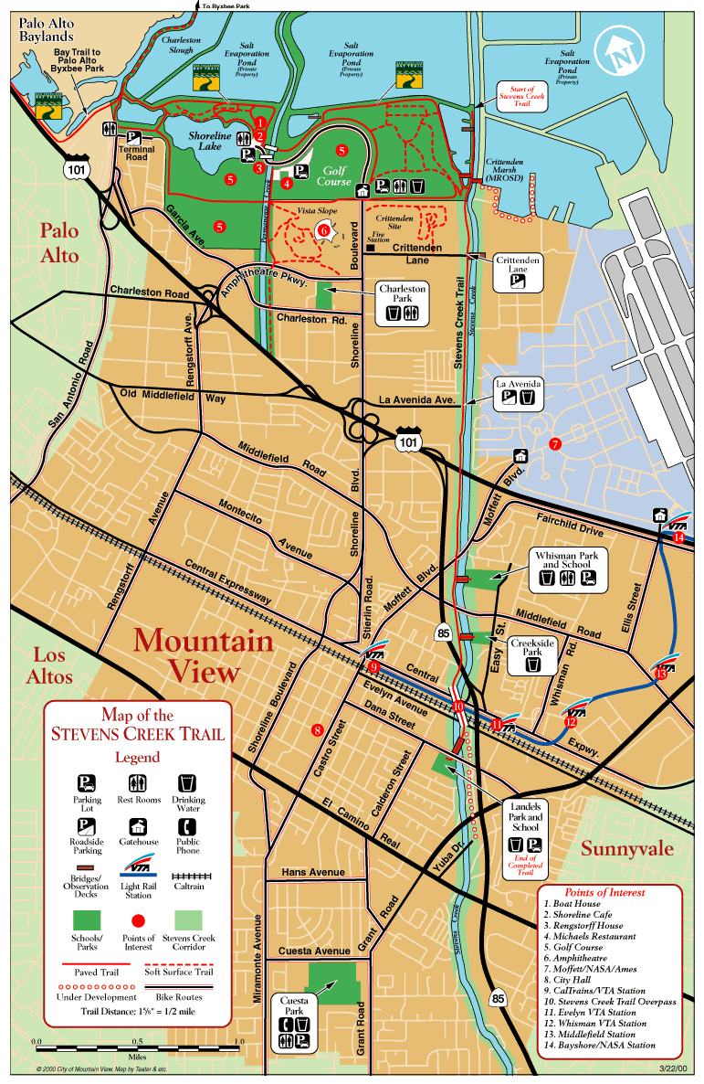
Below is a large map of the existing Stevens Creek Trail (courtesy of the City of Mountain View Web site). This Guided Tour covers the Trail from its southern end at Landels School to Shoreline Park, as well as a portion of the Shoreline Trail system along San Fracisco Bay to Shoreline Lake.